Introduction: Discover the World Without Leaving Your Home
In a world where technology is shrinking borders, Google Earth stands out as one of the most revolutionary tools ever developed. Whether you’re an adventurer, a student, a researcher, or someone with a curiosity about far-off places, Google Earth allows you to explore the planet right from your smartphone or computer.
In this guide, we’ll dive deep into what Google Earth is, how it works, its features, educational uses, and how you can make the most out of it in 2025.
What is Google Earth?
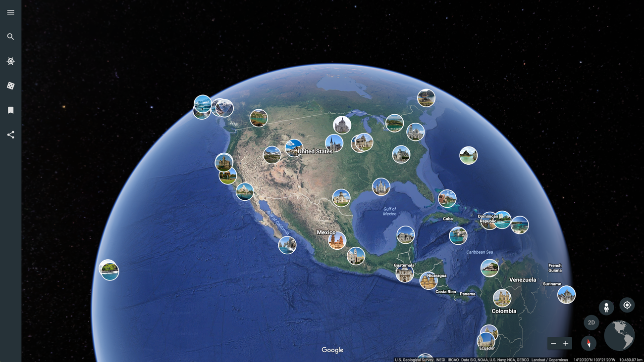
Google Earth is a virtual globe software developed by Google. It uses satellite imagery, aerial photography, and GIS (geographic information system) data to create a 3D representation of Earth. Users can explore terrains, view buildings in 3D, and even take guided tours through different locations around the world.
Originally launched in 2001, Google Earth has gone through several upgrades and is now available as a web app, mobile app, and a downloadable desktop version.
Key Features of Google Earth in 2025
🌍 1. 3D Globe View
Google Earth gives users a stunning 3D view of the Earth, allowing you to fly over mountains, dive into valleys, and view buildings in major cities in incredible detail.
🛰️ 2. High-Resolution Satellite Imagery
View your hometown, famous landmarks, or remote islands with high-resolution satellite imagery. The clarity and accuracy are improving each year.
🕰️ 3. Historical Imagery
Go back in time and view how specific places have changed over the years. Ideal for comparing natural changes, urban development, and more.
🧭 4. Voyager Stories & Guided Tours
Google Earth’s Voyager feature offers interactive tours created by scientists, educators, and storytellers. From nature documentaries to space explorations, there’s something for everyone.
🔍 5. Street View Integration
Zoom into the street level with Street View. Walk through Times Square, visit the Eiffel Tower, or explore the streets of Tokyo – all virtually.
📏 6. Measurement Tools
Measure distances and areas using built-in tools – perfect for students, travelers, and researchers.
How to Use Google Earth on Mobile and Desktop
✅ Web Version
Visit earth.google.com and start exploring instantly without downloading anything.
📱 Mobile App
Download the Google Earth app from the Play Store or App Store. The mobile version comes with touch navigation, location search, and many of the same features as the desktop.
💻 Desktop Pro
Google Earth Pro is free to download and includes advanced tools for map creation, importing GIS data, and creating 3D fly-through videos.
Educational Uses of Google Earth
Google Earth has transformed how we learn geography and environmental science. Teachers and students can use it to:
-
Explore different biomes and ecosystems
-
Study the effects of climate change over time
-
Learn about cultural landmarks around the world
-
Create custom map projects for presentations
Google Earth vs Google Maps: What’s the Difference?
Many people confuse Google Earth with Google Maps, but they serve different purposes:
| Feature | Google Earth | Google Maps |
|---|---|---|
| Purpose | Exploration and visualization | Navigation and location services |
| Imagery | 3D satellite and aerial view | 2D with limited 3D |
| Street View | Yes | Yes |
| Route Planning | No | Yes |
| Educational Use | High | Medium |
Benefits of Using Google Earth
-
Visual Learning – Understand geography and history through visual experiences
-
Travel Planning – Preview destinations before visiting
-
Home Design & Real Estate – View neighborhoods and property surroundings
-
Environmental Monitoring – Check forest coverage, coastline changes, and more
Hidden Tricks and Tips for 2025
📍1. Use Search Like a Pro
Enter coordinates (latitude and longitude) to find specific locations quickly.
🎥2. Record Tours
With Google Earth Pro, record a narrated flyover tour for presentations or YouTube.
🧠3. Turn On Layers
Enable layers like roads, borders, and 3D buildings for more context while exploring.
💡4. Explore the Moon & Mars
Yes, Google Earth lets you explore the Moon, Mars, and even the sky!
SEO Keywords to Target:
-
Google Earth 2025
-
Explore the world virtually
-
Google Earth features
-
Virtual globe tool
-
Google Earth vs Google Maps
-
3D satellite imagery tool
-
Educational tools for geography
-
Free Earth exploration software
Conclusion: See the World in a New Way
Whether you’re a student trying to learn geography, a traveler planning your next trip, or just someone curious about how the world looks from space, Google Earth is your perfect companion. It’s free, it’s powerful, and it keeps getting better.